
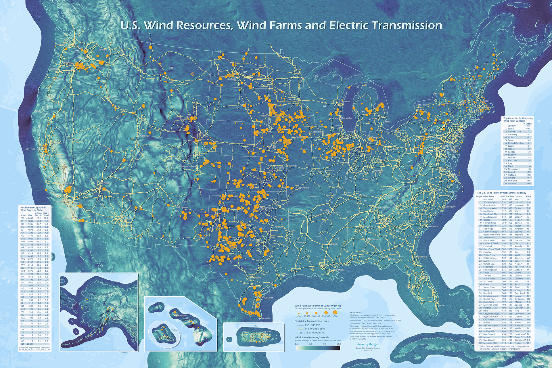
Map features U.S. wind resources, wind farms, and high-voltage electric transmission lines. The largest 50 wind farms (by capacity) are numbered on the map as well as shown in a ranked list. In addition, the map includes rankings of states and countries by total wind farm capacity.
Technical notes:
Wind resources are measured by annual wind speed (meters/second) at 100 meters above the surface level.
Includes all wind farms in the U.S. with at least 1 MW nameplate capacity. Wind farms were aggregated from plant-level data from the U.S. Energy Information Administration. Wind farm information was verified using various public websites and individual wind turbine data from the USGS.
The size of the wind farm markers are based on their net summer capacity. Some markers were moved slightly to improve visibility.
Sources:
Wind resources - National Renewable Energy Laboratory (continental U.S.) and Global Wind Atlas (all other areas).
Wind farms - U.S. Energy Information Administration, EIA-860M survey (Dec. 2023 data).
Wind turbines - USGS, U.S. Wind Turbine Database (Nov. 28, 2023).
Transmission lines - HIFLD Open Data (updated July 2022).
Operating wind farm capacity by country - Global Wind Power Tracker, Global Energy Monitor (Dec. 2023).